

Key Takeaways
- The continental US contains at least six distinct climate zones, each with meaningfully different seasonal patterns.
- Misreading a destination's climate zone is one of the most common causes of poorly timed trips.
- Elevation can override a region's general climate zone — mountain destinations behave differently than surrounding lowlands.
- Coastal proximity moderates temperatures significantly, especially in California and the Pacific Northwest.
- NOAA's 30-year climate normals are a reliable, free resource for pre-trip weather research.
- Off-season travel often makes sense in some zones and carries real risks in others — knowing the zone clarifies the trade-off.
US Climate Zone
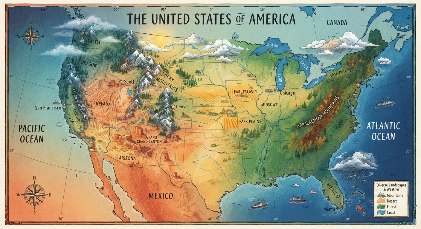
A US climate zone is a geographic region classified by its characteristic patterns of temperature, precipitation, humidity, and seasonality. The continental United States contains six broadly recognized climate types — from humid subtropical in the Southeast to semi-arid and arid zones across the interior West — plus distinct conditions in Alaska and Hawaii. Knowing which zone a destination falls into helps travelers anticipate what weather to expect and choose the right time to visit.
The Köppen climate classification system is the most widely used framework for categorizing US climates; NOAA also publishes regional climate normals based on 30-year averages that provide granular seasonal data.
Why Climate Zone Literacy Matters Before You Book
Most trip-planning mistakes aren't about destination choice — they're about timing. A traveler who books a Smoky Mountains hike in mid-July without understanding the region's humid subtropical climate may face heat indexes above 100°F and afternoon thunderstorms. Someone arriving in Seattle in August expecting rain may be surprised by weeks of dry sunshine. Climate zone literacy bridges the gap between a beautiful destination photo and realistic on-the-ground conditions.
The United States is geographically enormous, and its weather diversity reflects that scale. A domestic trip can mean booking into conditions as different as a Sonoran Desert afternoon at 110°F or a November snowstorm in the Upper Peninsula of Michigan. Understanding which zone your destination falls into — and how that zone behaves seasonally — is the single most useful pre-trip research step most travelers skip.
6+
Distinct climate zones in the continental US
Climate scientists using the Köppen classification identify at least six major climate types across the 48 contiguous states, plus additional categories for Alaska and Hawaii.
3–5°F
Temperature drop per 1,000 feet of elevation gain
This standard atmospheric lapse rate means mountain destinations can be dramatically cooler than surrounding lowland areas, even within the same regional climate zone.
June–Nov
Atlantic hurricane season affecting the Southeast
According to NOAA, the official Atlantic hurricane season runs June 1 through November 30, with peak activity typically occurring between mid-August and mid-October.
The Six Major US Climate Zones at a Glance
While climate classification systems vary in their granularity, six broad types cover most of the continental US:
- Humid Continental (Midwest, Great Lakes, New England): Hot summers, cold winters, precipitation spread year-round. The zone responsible for the US's most dramatic seasonal swings.
- Humid Subtropical (Southeast, Gulf Coast): Mild winters, hot and muggy summers. Hurricane season runs June through November, making late summer travel to coastal areas in this zone particularly weather-sensitive.
- Semi-Arid / Steppe (Great Plains, interior West): Low precipitation, wide temperature swings between day and night and between seasons. Spring tornado risk is significant across the southern plains.
- Arid / Desert (Southwest, including Arizona, Nevada, southern California interior): Extreme heat in summer, mild winters. The Sonoran Desert around Tucson and Phoenix sees monsoon moisture in July and August.
- Mediterranean (coastal California): Dry, warm summers and mild, wet winters — the most uniformly temperate zone in the country for year-round travel.
- Oceanic (Pacific Northwest coast): Mild temperatures year-round, abundant rainfall in fall through spring, dry summers. Often misread by travelers expecting rain in August.
For travelers planning trips into national parks across these zones, our guide to major US national parks offers destination-specific context for each region.
Elevation and Coastal Proximity: The Overrides
Climate zone maps show broad strokes, but two local factors frequently override regional generalizations: elevation and proximity to the ocean.
Elevation is the more dramatic of the two. Flagstaff, Arizona is technically surrounded by desert, yet it averages over 100 inches of snow per year because of its 7,000-foot altitude. The same principle applies throughout the Rockies, Sierra Nevada, and Cascades — trails may be snow-covered well into June at higher elevations even as valley towns below enjoy spring conditions. Travelers planning hikes in the Desert Southwest or Pacific Northwest should always check trail-specific elevation data, not just the destination city's forecast.
Coastal proximity moderates temperature swings. San Francisco's summers are famously cool and foggy despite being classified as Mediterranean, because cold Pacific currents suppress inland heat from reaching the coast. Meanwhile, just 50 miles inland, Sacramento regularly exceeds 100°F in July. Understanding this distinction prevents the common mistake of packing for the wrong version of a California summer.
Cross-Check Elevation Before You Pack
When researching a destination's weather, always look up the specific elevation of your trailhead, campsite, or lodging — not just the nearest city's forecast. Mountain towns and high-country parks routinely see conditions 20–30°F cooler than the valley below. NOAA's forecast pages list elevation for each weather station, making it easy to find the most relevant data point for your actual location.
Using Climate Data Practically When Planning
NOAA publishes climate normals — 30-year averages of temperature, precipitation, and other variables — for hundreds of weather stations across the US. These are available free online and give travelers a statistically grounded picture of what to expect in any given month, rather than relying on a single recent year's weather or anecdotal reports.
For multi-state road trips, climate zone differences become even more consequential. A route from Denver to New Orleans in April passes through semi-arid, humid continental, and humid subtropical zones — each with meaningfully different conditions. Our guide to planning a multi-state road trip addresses how to sequence destinations with this kind of variability in mind.
Before heading into protected wilderness, consult zone-specific hazard calendars in addition to general forecasts. Wildfire smoke affects mountain zones differently each year; flood risk in canyon country can make slots impassable after distant rainfall. Our national park pre-trip checklist includes climate and safety verification steps worth reviewing regardless of destination.
Weather conditions vary year to year and forecasts can change rapidly. Always verify current conditions and any entry or safety requirements with official park and government sources before traveling.